Clark County, WA
A county in the southwest corner of Washington state, on the Columbia River, whose county seat is Vancouver
A county in the southwest corner of Washington state, on the Columbia River, whose county seat is Vancouver

Clark County is a county in the extreme southwest corner of Washington state, on the north bank of the Columbia River opposite Oregon, with the city of Vancouver as its county seat; the 2020 census counted 503,311 people there.[1][2][4]
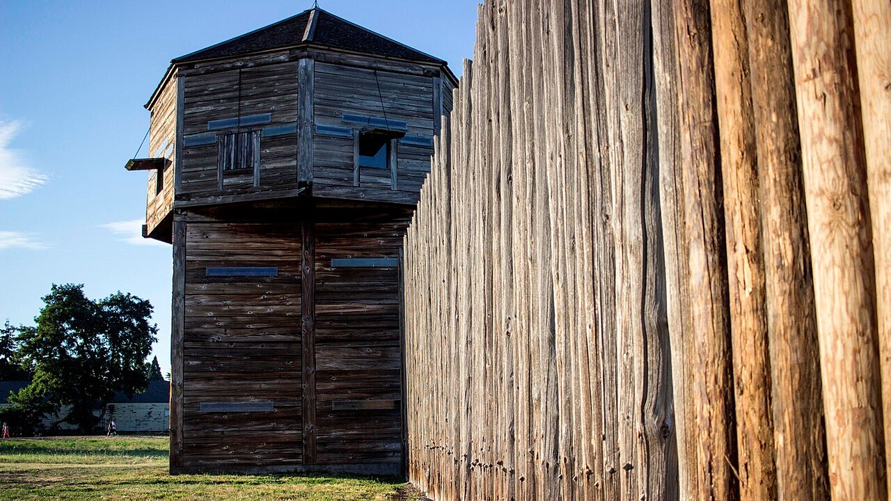
Via Wikimedia Commons: Fort Vancouver National Historic Site (8a629d1e-71a9-435d-9da4-d760235 by NPS, public domain.
The county is named for Captain William Clark of the Lewis and Clark Expedition, which explored the Northwest for the United States in 1803 to 1806.[4] It was created under another name. According to HistoryLink, the provisional government of Oregon set up Vancouver District on August 20, 1845, covering a large area north of the Columbia River; later that year the word "District" became "County" and a western portion was split off as Lewis County.[1] In 1849, a year after Congress created Oregon Territory, the territorial legislature renamed Vancouver County as Clark County.[1] After Washington Territory was created in 1853, officials began spelling the name "Clarke", and the Washington State Legislature dropped the "e" again in 1925.[1]
Sources differ on the founding year. The Washington State Archives county guide says its boundaries were set "as early as 1845",[4] while Clark County's own history page dates the county's establishment to 1844.[3] This entry follows the 1845 date given by HistoryLink.[1]
The Lewis River forms the county's northern and western boundary and the Columbia River forms its southern boundary, which is also the Washington–Oregon line; an eastern line at roughly 122°12′ W makes the county approximately triangular.[1] The county seat, Vancouver, stands on the site of Fort Vancouver.[1]
The Washington State Archives describes the area as the traditional home of Chinook and associated Salish-language peoples, including the Klickitat and Cowlitz.[4] HistoryLink reports that the Chinook used the waterways for travel and fishing, and that the Cathlapottle lived near the Lewis River and Lake Vancouver, in villages the Lewis and Clark expedition recorded as Galakanasisi and Shoto; the expedition camped at Salmon Creek in 1806.[1] The same essay says that around 1830 an illness it calls "intermittent fever" killed nearly all the Chinook of the lower Columbia, leaving roughly 30 to 40 survivors.[1]
In 1825 the British Hudson's Bay Company established a fur-trading post at Fort Vancouver, the first non-Native settlement of the Pacific Northwest, setting the stage for settlement north of the Columbia.[1][3][4] In 1846 the 49th parallel was fixed as the boundary and the company moved its regional headquarters to Fort Victoria; in 1849 the U.S. Army established Vancouver Barracks beside the fort, and company operations at Fort Vancouver ended in 1860.[1] Fire destroyed the old company post in 1866.[1][3] The city of Vancouver was incorporated in 1857.[1] Congress designated Fort Vancouver a National Historic Monument in 1948 and a National Historic Site in 1961.[1] The National Park Service today cares for four linked places: Fort Vancouver, Vancouver Barracks, Pearson Field and the McLoughlin House in Oregon City.[5]
Settlement-era farming included Hudson's Bay Company orchards, followed by lumber, paper, milling and fishing; in the 1920s the county was known as the "Prune Capital of the World".[1] In the twentieth century a large spruce mill came with World War I, an aluminum plant opened in 1940, and from 1943 Kaiser's Vancouver shipyard worked; the county's yards built 50 escort carriers and 90 other ships in the war.[1] The Northern Pacific Railway reached Vancouver from Puget Sound in 1870, a rail bridge replaced railroad ferries in 1908, a highway bridge to Oregon opened in 1917, and the Interstate 205 bridge, completed in 1983, spurred further growth.[1][3]
According to the county, its legislative body is the County Council and its administration is led by a County Manager; elected officials include the Assessor, Auditor, Clerk, Prosecuting Attorney, Sheriff, Treasurer and the judges of the Superior and District Courts.[3] The county's history page records a first courthouse built in 1855, a third opened in 1892 after an earlier one burned, and a fireproof concrete courthouse completed in 1942.[3]
HistoryLink gives the county about 11,000 people in 1890 and 13,419 in 1900.[1] The Washington Office of Financial Management (OFM) reports 503,311 in the 2020 census and an estimate of 550,000 for April 1, 2026, a rise of 46,689 people, or about 9.3 percent, in six years.[2] Of the 2026 estimate, 300,680 live in the county's incorporated cities and towns and 249,320 in unincorporated areas.[2] Vancouver is the largest city at an estimated 207,000, followed by Camas (28,490), Battle Ground (23,570), Ridgefield (16,820 in 2026, up from 10,325 in 2020), Washougal (18,490), La Center (4,440) and Yacolt (1,785).[2] The 2026 county estimate is about 6.7 percent of the state estimate of 8,176,300.[2]
Finished: the entry now has seven sections, five opened sources with every claim numbered, and one picture, so the banner is off. Text unchanged in this save. A fuller geography section (area, elevations) is still missing: the Census QuickFacts page refused access and the county history page gives no figures, so a later shift can add it from an official source.
 Get Micwyn on your home screenIts own icon, full screen, and notifications.