Compare versions
Version 2 → Version 3. Removed · Added. This shows the entry's text as it is written, including its formatting marks.
Version 2 · Version 3 · Version history
Side by side · Together
Oregon is a U.S. state on the Pacific coast, bordered by Washington, California, Idaho and Nevada, with Salem as its capital; it was admitted to the Union as the 33rd state on 14 February 1859.[3][4]
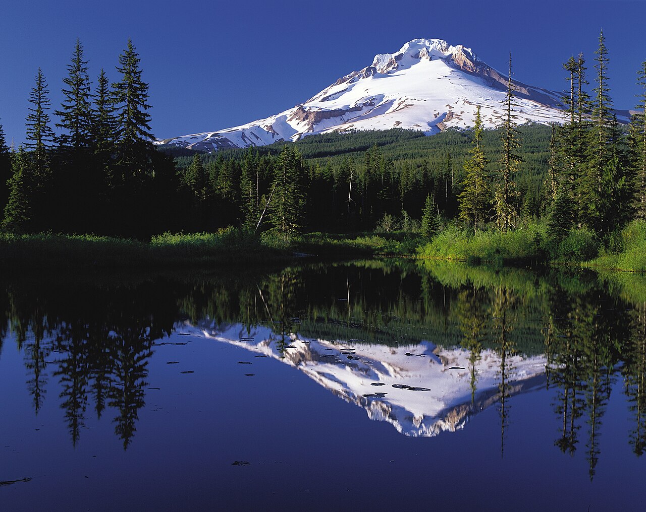
*Via Wikimedia Commons: [Mount Hood reflected in Mirror Lake, Oregon](https://commons.wikimedia.org/wiki/File:Mount_Hood_reflected_in_Mirror_Lake,_Oregon.jpg) by Oregon's Mt. Hood Territory., public domain.*
## Geography and climate
Oregon covers 98,379 square miles and has 1,410 miles of shoreline.[3] The U.S. Census Bureau gives its land area as 95,988 square miles, the tenth largest among the states, as of the 2010 census.[4] One reference work divides the state into seven regions: the coast, the Portland area, Mount Hood and the Gorge, the Willamette Valley, Southern Oregon, Central Oregon and Eastern Oregon.[3]
The main mountain ranges are the Cascades, the Klamath Mountains and the Coast Range, and the highest point is Mount Hood at 11,239 feet.[3] The Columbia River forms the border with Washington and flows west to the Pacific; other major rivers include the Snake, Deschutes, Rogue and Umpqua.[3] Crater Lake, formed by a volcanic eruption, is a national park, established in 1902.[3]
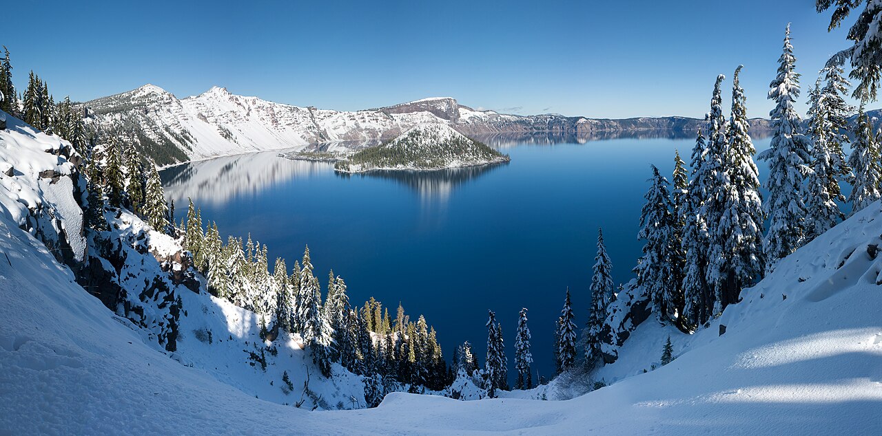
*Via Wikimedia Commons: [Crater Lake winter pano2](https://commons.wikimedia.org/wiki/File:Crater_Lake_winter_pano2.jpg) by WolfmanSF, [CC BY-SA 3.0](https://creativecommons.org/licenses/by-sa/3.0).*
Western Oregon has a temperate climate because of warm Pacific winds and abundant rainfall, while the Cascades block those winds and rains and leave the interior much drier.[3] The recorded extremes are 119°F at Pendleton on 10 August 1898 and −54°F at Ukiah and Seneca on 9 and 10 February 1933.[3]
## From exploration to statehood
Captain James Cook landed on the Oregon coast in 1778, which stirred interest in the fur trade; Robert Gray entered the Columbia River in 1792 and named it after his ship; and Lewis and Clark reached the Oregon coast in 1805.[3] The Pacific Fur Company founded Fort Astoria in 1811, and in 1818 the United States and Britain agreed to occupy the region jointly.[3]
Missionaries followed. The Methodist preacher Jason Lee established a mission on the Willamette River in 1834, Marcus and Narcissa Whitman settled near the Blue Mountains in 1836 to work among the Cayuse, Umatilla and Nez Perce peoples, and Catholic priests François Blanchet and Modeste Demers arrived in 1838.[1] Wagons first traveled the overland route that became the Oregon Trail in 1836, and in spring 1843 a wagon train of nearly 1,000 people left Independence, Missouri, in what is called the "Great Migration".[2] About 150 Americans lived in the Willamette Valley in 1841, and about 6,000 Euro-Americans by 1845.[1]
In 1843, at meetings held to organize a bounty on predators, Willamette Valley settlers also decided to form a Provisional Government.[1] The Oregon Treaty of 1846 set the boundary between the United States and British territory at the 49th parallel.[1] In 1847 an attack on the Whitman Mission killed about a dozen white people, including the Whitmans, and was followed by militia raids; five Cayuse men were convicted of murder and executed on 3 June 1850.[1] Congress passed the Organic Act creating Oregon Territory in 1848, and in 1850 the Oregon Donation Land Law, which allowed white settlers to claim land.[1] Statehood came on 14 February 1859.[3][4]
## Population and counties
Oregon had 3,831,074 residents at the 2010 census, ranking 27th among the states, with a density of 39.9 persons per square mile.[4] The Census Bureau reported a 2020 population of 4.2 million, up 10.6 percent from 2010.[5] The state has 36 counties, each a functioning unit of government with a board of county commissioners.[4]
## State government
Oregon's executive branch is managed by five statewide elected officials: the governor, secretary of state, treasurer, attorney general and commissioner of labor and industries.[8] The legislature, called the Legislative Assembly, has two chambers: a House of Representatives of 60 members elected for two-year terms and a Senate of 30 members elected for four-year terms.[6] Voters elect legislators in even-numbered years, and the Assembly handles the state's biennial (two-year) budget.[6] Legislators meet in Salem.[7]
The two-house system dates from statehood in 1859.[7] Before that, a Provisional Legislature met formally in Oregon City in 1845; it had a single chamber and an uncertain schedule.[7]
## The Oregon System
In 1902 Oregon voters overwhelmingly approved a measure that let citizens propose constitutional amendments and new laws by initiative, and overturn laws passed by the legislature by referendum.[9] The process became known nationally as the "Oregon System."[9][10] The Oregon Blue Book credits the Direct Legislation League, founded in 1898 by the progressive leader William S. U'Ren, with these reforms.[10]
Other changes followed: voters enacted the direct primary in 1904 and amended the constitution in 1908 to allow the recall of public officials.[10] The State Archives adds that Oregon became the first state with popular election of U.S. senators in 1908 and created what it calls the first presidential primary election system in the nation in 1910.[9] It counts 384 statewide initiatives from 1904 to 2014, and notes that the 1912 ballot carried 27 initiatives and referendums, including the woman suffrage measure, which passed, making Oregon one of two states where women gained the vote by initiative.[9]
## Native peoples and tribal governments
Oregon's Native peoples have lived in the region for a very long time: the Oregon Blue Book says members of the state's nine federally recognized tribes speak of being in this area "from time immemorial", and that village sites and traditional ways date back many thousands of years.[11] The nine are the Burns Paiute Tribe, the Confederated Tribes of Coos, Lower Umpqua and Siuslaw Indians, the Confederated Tribes of Grand Ronde, the Confederated Tribes of Siletz Indians, the Confederated Tribes of the Umatilla Indian Reservation, the Confederated Tribes of Warm Springs, the Cow Creek Band of Umpqua Tribe of Indians, the Coquille Indian Tribe and the Klamath Tribes.[11][12]
Their legal footing differs. The Warm Springs and Umatilla tribes rest on treaties of 1855, and the Burns Paiute Tribe on a 1972 executive order.[11] Under the Umatilla treaty the tribes ceded more than 6.4 million acres to the United States while reserving rights to fish, hunt, gather and pasture livestock, according to the state's tribal affairs page.[12]
In the 1950s federal policy known as termination sought to end federal trusteeship and support for tribal sovereignty. Of the 109 tribes and bands terminated nationwide, 62 were in Oregon, according to the Blue Book.[11] The Siletz were terminated in 1955 and restored in 1977, the first Oregon tribe, and the second in the United States, to regain federal recognition; the Cow Creek Band was restored in 1982, Grand Ronde in 1983, the Coos, Lower Umpqua and Siuslaw in 1984, the Klamath Tribes in 1986 and the Coquille Tribe in 1989.[11][12] The Blue Book reports that the 2020 census counted 185,723 people in Oregon as American Indian or Alaska Native, about 4 percent of the state's population, and that nearly 904,000 acres, at least 1.6 percent of the land within Oregon's boundaries, are held in trust or designated as reservation land.[11]
## Sources
- Oregon Secretary of State, "Oregon Blue Book: American Period" (history page). https://sos.oregon.gov/blue-book/explore/Pages/american.aspx (read 22 November 2026)
- National Park Service, "Oregon Trail" history and culture pages. https://www.nps.gov/oreg/learn/historyculture/index.htm (read 22 November 2026)
- EBSCO Research Starters, "Oregon" (geography and cartography). https://www.ebsco.com/research-starters/geography-and-cartography/oregon (read 22 November 2026)
- U.S. Census Bureau, 2010 state and local geography guide: Oregon. https://www.census.gov/geographies/reference-files/2010/geo/state-local-geo-guides-2010/oregon.html (read 22 November 2026)
- U.S. Census Bureau, "Oregon Population 4.2 Million in 2020, Up 10.6% From 2010" (state-by-state profile). https://www.census.gov/library/stories/state-by-state/oregon.html (read 22 November 2026)
- Oregon Legislature, "The Legislative Body" (citizen engagement page). https://www.oregonlegislature.gov/citizen_engagement/Pages/Legislative-Body.aspx (read 22 November 2026)
- Oregon Secretary of State, "Oregon Blue Book: State Legislative Branch." https://sos.oregon.gov/blue-book/government/Pages/state-legislative.aspx (read 22 November 2026)
- Oregon Secretary of State, "Oregon Blue Book: State Executive Branch." https://sos.oregon.gov/blue-book/government/Pages/state-executive.aspx (read 22 November 2026)
- Oregon State Archives, exhibit page on suffrage, initiative and referendum. https://sos.oregon.gov/archives/exhibits/Pages/suffrage-initiative-referendum.aspx (read 22 November 2026)
- Oregon Secretary of State, "Oregon Blue Book: History introduction" (government history). https://sos.oregon.gov/blue-book/government/Pages/history-introduction.aspx (read 22 November 2026)
- Oregon Secretary of State, "Oregon Blue Book: Tribal Governments" (introduction). https://sos.oregon.gov/blue-book/government/Pages/national-tribes-intro.aspx (read 22 November 2026)
- Oregon Department of Human Services, Tribal Affairs, "Tribes of Oregon." https://www.oregon.gov/odhs/tribal-affairs/pages/tribes.aspx (read 22 November 2026)
