Snowball Earth
Hypothesis that ice covered nearly all of Earth during ancient glaciations, above all in the Cryogenian Period
📖 Dictionary: Snowball Earth · 📚 Library
Hypothesis that ice covered nearly all of Earth during ancient glaciations, above all in the Cryogenian Period
📖 Dictionary: Snowball Earth · 📚 Library

Snowball Earth is the hypothesis that ice once covered Earth almost entirely, from the poles to the equator, most famously in two long glaciations of the Cryogenian Period, between about 717 and 635 million years ago.[1] Whether the oceans froze over completely is still debated.[1][7]
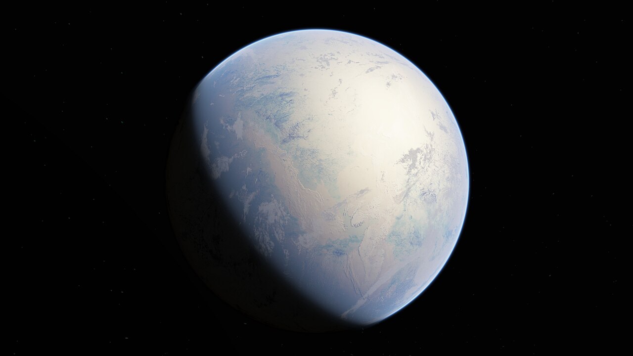
Via Wikimedia Commons: Snowball Huronian by Oleg Kuznetsov - 3depix - 3depix.com/, CC BY-SA 4.0.
Glacial deposits laid down in the late Precambrian are found on almost every major continent, and some of them appear to have formed close to the equator.[2] In 1992 Joseph Kirschvink proposed an explanation: at times the whole planet was covered with sea ice and glaciers, so that Earth "would have resembled a highly reflective 'snowball'".[2] He called this the "Snowball Earth".[2]
The phrase is now used in two related senses. A 2017 review by Paul Hoffman and 26 co-authors in Science Advances uses "theory" for the mechanism that could freeze a planet over, and "hypothesis" for the claim that it actually happened in Earth's past.[1] The same review counts two consecutive Snowball episodes in the Neoproterozoic Era and at least one earlier one, in the Paleoproterozoic Era, with almost no ice sheets known in the 1.5 billion years between them.[1]
The puzzle that led to the hypothesis was older than the name. Kirschvink noted that arguments for low-latitude glaciation in the late Precambrian had been discussed for about 30 years, going back to work by W. B. Harland in 1964.[2] Several features of the glacial deposits seemed out of place. Some contained an unusual amount of carbonate rock fragments, as if the ice had moved over carbonate platforms, and some, such as the Rapitan Group of the Canadian Cordillera, are bounded above and below by thick carbonate sequences, a kind of rock that, for at least the past 100 million years, has formed only within about 33° of the equator.[2] Dropstones (stones dropped from floating ice) and varves (annual layers of sediment) also occur in these carbonates.[2]
Magnetic evidence was the second line. Kirschvink judged most early paleomagnetic data (the record of Earth's magnetic field locked into rocks, which can show the latitude where they formed) to be unconvincing, but singled out studies of the varved sediments of the Elatina Formation in South Australia, which in his reading showed widespread sea-level glaciation within a few degrees of the equator.[2] Hoffman and colleagues write that the worldwide distribution of these deposits had been evident since the 1930s, but that geologists were long divided over whether it recorded extraordinary climates or simply continents drifting through polar latitudes at different times.[1]
The theory rests on the ice-albedo feedback. Albedo is the share of sunlight a surface reflects: ice and snow reflect much more than open ocean, so as ice spreads, the planet absorbs less sunlight and cools further.[1] Hoffman and colleagues note that for 50 years climate models of increasing complexity have hinted that Earth could be pushed into global glaciation this way.[1] In simple energy-balance models of the Budyko-Sellers type, once the edge of the ice reaches a critical latitude it advances uncontrollably to the equator.[1]
Kirschvink offered a reason why the late Precambrian might have been vulnerable. Large areas of the continents probably lay in low and middle latitudes, a situation not repeated later in Earth's history; since most of the solar energy Earth absorbs is taken up by the tropical oceans, replacing tropical ocean with more reflective land could have tipped the climate towards glaciation, and a small drop in sea level would have exposed still more reflective land.[2] Hoffman and colleagues add that the older Cryogenian glaciation, the Sturtian, followed the breakup of a tropical supercontinent (Rodinia), and that its onset coincided with the outpouring of a large igneous province, the Franklin flood basalts of northern Laurentia (ancient North America), near the equator.[1]
A frozen planet could seem permanent, since ice reflects so much sunlight. Kirschvink proposed a way out: carbon dioxide from volcanoes would keep entering the air, while the ice would shut down the two main processes that remove it, the chemical weathering of silicate rocks and photosynthesis.[2] The greenhouse effect would build until the ice melted.[2] He also raised the risk that the poles might grow cold enough to freeze carbon dioxide into dry ice, which would remove the greenhouse rescue and leave a permanent ice catastrophe.[2] For the Cryogenian, Hoffman and colleagues conclude that an ice-covered Earth-like planet stays far below the threshold for carbon dioxide ice to form, but that the risk is harder to dismiss for the older, Paleoproterozoic Snowball about 2.4 billion years ago, when the Sun was about 10% dimmer.[1]
The model makes predictions that can be tested in rocks. Snowball glaciations should be long-lived, because so much carbon dioxide must build up to overcome the high albedo; they should begin at the same time at low latitudes and end at the same time everywhere; and they should end with extremely high atmospheric carbon dioxide, equivalent to 10,000 to 100,000 parts per million in the present atmosphere, followed by a hot greenhouse climate.[1] Current estimates of the carbon dioxide level needed to end a Cryogenian Snowball range from 1% to 10% of the atmosphere by volume, depending on how reflective the tropical ice was.[1] Once the tropical ocean begins to open, the ice-albedo feedback works in reverse and drives the ice edge rapidly towards the poles, in about 2,000 years in the models; weathering and burial of carbon then lower the carbon dioxide again over some ten million years.[1]
Kirschvink suggested that floating pack ice would cut the oceans off from the oxygen in the air, so that the deep water would become stagnant and anoxic and dissolved iron would build up, then precipitate when circulation returned at the end of the glaciation.[2] This, he proposed, explained the banded iron formations, iron-rich layered rocks, found with late Precambrian glacial deposits in Canada, Brazil, Australia and South Africa, including in the Rapitan Group, where they are interbedded with glacial deposits and contain occasional dropstones.[2]
In 1998 Hoffman, Alan Kaufman, Galen Halverson and Daniel Schrag published a paper in Science that set out new evidence for it.[3] Studying carbonate rocks above and below Neoproterozoic glacial deposits in Namibia, they found negative carbon-isotope anomalies which, combined with estimates of how the region subsided, suggested that biological productivity in the surface ocean collapsed for millions of years.[3] They argued that a global glaciation explained this, and that it ended abruptly when volcanic gases raised atmospheric carbon dioxide to about 350 times the modern level.[3] In their account the sudden warming and the transfer of carbon dioxide into the ocean would have caused calcium carbonate to precipitate rapidly in warm surface waters, producing the "cap carbonate" rocks found worldwide on top of the glacial deposits.[3]
The 2017 review describes these terminal carbonate deposits as unique to the Cryogenian glaciations and as products of intense weathering and a stratified ocean.[1] The end of the Sturtian glaciation is marked worldwide by an organic-rich "cap limestone", and the end of the Marinoan by a laterally continuous layer of pale, pinkish-to-beige dolostone, a "cap dolostone", which sits directly on the last glacial deposits without an evident gap.[1]
When the hypothesis was proposed, no Cryogenian glacial deposit had been dated directly, and none was until 2004.[1] By 2017, uranium-lead dating of zircon crystals from volcanic ash and rhenium-osmium dating of organic-rich sediments had fixed the start of the Sturtian glaciation and the ends of both glaciations to within about a million years, on several ancient continents.[1] Hoffman and colleagues call this "a remarkable achievement" and the main reason geologists now take the hypothesis seriously.[1]
The two glaciations are named after Sturt Gorge and Marino Rocks near Adelaide, South Australia, where their deposits were recognised and mapped more than a century ago.[1] As summarised in the 2017 review:
The roughly simultaneous starts and ends on different continents are what the Snowball model predicts.[1] A 2019 study in the Proceedings of the National Academy of Sciences by C. Brenhin Keller and colleagues gives three well-established Neoproterozoic glacial intervals that reached low latitudes: the Sturtian (717 to 660 million years ago) and Marinoan (641 to 635 million years ago), both envisioned as global "snowball" events, and the Gaskiers (about 580 million years ago), an extensive but not global glaciation.[4]
A global freeze poses an obvious problem: how did life survive it? Kirschvink pointed out that the glacial episode marks a turning point in the history of life, preceded by evidence of protists and prokaryotes and followed by the first clear record of animals, the Ediacaran fauna, and soon after by animals with mineralised skeletons in the Cambrian.[2] The 2017 review links the paired Cryogenian Snowballs with the emergence of multicellularity in animals, and notes that sterane molecules from South Oman, interpreted as products of demosponges, appear no later than the interlude between the two glaciations.[1]
The 2017 review proposes that dust collecting on tropical sea ice would have created meltwater ponds and holes ("cryoconite") favourable for cyanobacteria and certain eukaryotes, and points to dry valleys warmed by winds from adjacent ice sheets as likely refuges for hardy microbes, by comparison with life in Antarctica's McMurdo Dry Valleys today.[1] In its model the sea ice thickens into a "sea glacier" that flows towards the equator, and the tropics become a desert while snow and frost accumulate elsewhere.[1]
The hypothesis has been contested since it gained attention. One line of criticism comes from climate modelling. In 2000 William Hyde, Thomas Crowley, Steven Baum and W. Richard Peltier published coupled climate and ice-sheet simulations in Nature in which, in some runs, a belt of open water remained near the equator, which they suggested could have been a refuge for multicellular animals.[6] Such solutions, with dynamic ice sheets reaching sea level in the tropics but some open ocean left, are grouped by Hoffman and colleagues under the term "Waterbelt"; they note that they have also been called "slushball" or "soft-snowball" solutions, and that some of this work was motivated by the view that a hard Snowball is implausible in light of the fossil record.[1] The review argues that such states are hard to model, because they sit close to the threshold for a full freeze yet must avoid falling into it for millions of years.[1]
A second line comes from the rocks themselves. In a 2008 paper in Nature Geoscience, Philip Allen and James Etienne argued that sedimentary rocks laid down during the cold intervals show that dynamic glaciers and ice streams kept delivering large amounts of sediment to open oceans throughout the glacial cycle, so that some oceans must have remained free of ice.[7] They noted that significant areas of open ocean would matter both for the survival of life and for the global carbon cycle.[7]
The Cryogenian glaciations are also one of the proposed causes of the Great Unconformity, the surface in many parts of the world where Cambrian sediments rest on much older rock. Keller and colleagues proposed in 2019 that Neoproterozoic glacial erosion, averaging 3 to 5 vertical kilometres worldwide, cut much of it.[4] In 2020 Rebecca Flowers and colleagues reported evidence from Colorado that most of the erosion there happened before the Sturtian glaciation began 717 million years ago, and so cannot have been glacial.[5]
 Get Micwyn on your home screenIts own icon, full screen, and notifications.